Saturday, February 4, 2012

My Queen of Kabul - Nancy Dupree


Kabul, the city Nancy Dupree wrote a book on and fell in love with. Photo: Bob McKerrow

It has been most enjoyable and productive having Ebrahim Faghihi working with us on a Sri Lanka Red Cross flood recovery operation. Over dinner last night we spoke of those wonderful days in 95-96 when we spent time exploring Kabul with Nancy Dupree the great historian on Afghanistan and author of so many books on the country. Here is a photo I took of Ebrahim with Nancy in 1996 on the outskirts of Kabul..

I knew got to know Nancy in those difficult days in Kabul between 1993-96 when Nancy was living in Peshawar. She stayed at my house in Kabul on visits to Afghanistan a number of times and Ebrahim and I often did day tours of Kabul with her where she explained in minute details, every scrap of history she knew of.
Although working for the International Red Cross, I gave a lot of my spare time working with her and colleagues, rescuing treasures from the Kabul museum which was coming under bombing by the Talibans and looting from other warring factions. We also worked together on preserving the British (Foreigners) cemetary
in Kabul which hid a rich history from the time of the early Ango Afghan wars.
Honouring 45 years since the death of the great archaeologist Aurel Stein at his grave in the Kabul cemetary. Tim Johnston AFP (2nd from left) and Ahmed Gizo (right). We invited Nancy Dupree but was unable to make because of fighting in Kabul. Photo: Bob McKerrow

As I was able to travel freely in Afghanistan in the course of my work, I took photographs for Nancy of historic sites her and Louis thirty years earlier and brought her back photographs. She was so grateful and could never thank me enough.

When I published my book on Afghanistan in 2003 I dedicated it to "My Queen of Kabul, Nancy Dupree."

She was grateful to get a copy of my book but I much more grateful to have autographed copies of all her books, which guided me through Afghanistan.

She would tell me over a wine at nights of her love affair with Afghanistan and her late husband Louis Dupree. These were romantic evenings around a log fire in Kabul, with a woman 20 years older than me, recounting her early and carefree days of the 1960s.

.
Kabul the city that Nancy Dupree fell in love with. Photo: Bob McKerrow
I haven't seen Nancy for 14 years but we kept in touch by email for a long time. Who better to tell her love story than C.M. Sennott from the GlobalPost who published this article in June 2009.

En­ter the steel gates that lead to the court­yard and well-tended gar­dens of a faded, but still el­e­gant, manse where Nancy Hatch Dupree greets us on the steps.

For a mo­ment, you feel what it must have been like to live here in the early 1960s.

That’s when Dupree first ar­rived in Kabul and where she would meet the two great loves of her life. The first was her hus­band, Louis Dupree, the dash­ing Amer­i­can para­trooper turned world-fa­mous arche­ol­o­gist. The sec­ond love was one they both shared: the cul­tural and his­toric riches of the rugged, mag­i­cal land­scape of Af­ghan­i­stan and its peo­ple.


As an arche­ol­o­gist and eth­nol­o­gist, Af­ghan­i­stan has been the fo­cus of their life’s work.
She and Louis, who passed away in 1989, lived through it all and suf­fered with the Afghans through the wars and cel­e­brated the life that has gone on in be­tween. She sur­vived the dark days of the civil war here in the early 1990s and the even darker days of the Tal­iban. Through it all, she stud­ied and worked to pro­tect and pre­serve the coun­try’s cul­ture and her­itage. To­day, there is no West­erner who knows the Afghan peo­ple like Nancy.

Some 45 years af­ter her ar­rival here, I meet with Dupree on a sunny day in the late af­ter­noon shad­ows of the once-grand home where she lives part of the year in down­town Kabul.

The rest of the year she lives just across the bor­der in Pe­shawar, Pak­istan, still writ­ing and re­search­ing at the age of 83. She di­vides her time be­tween the two cities, tend­ing an archive that is housed at Kabul Uni­ver­sity. The archive, an idea in­spired by Louis, is ded­i­cated to cre­at­ing a re­source cen­ter for all the dif­fer­ent aid work­ers and Afghan ex­perts who could no longer travel freely in war-torn Af­ghan­i­stan.

She looks heart­sick when she talks about the Tal­iban’s de­struc­tion of the two gi­ant Bud­dha carv­ings of Ba­mayan. She also wants to set the record straight that she was ne­go­ti­at­ing with the Tal­iban lead­er­ship to pro­tect the Bud­dhas, and be­lieves the de­ci­sion to dy­na­mite them was made by a mil­i­tant fringe closely con­nected to Al Qaeda. She in­sists that many in the Tal­iban gov­ern­ment were op­posed to the de­struc­tion, but the mil­i­tants had run away with the Tal­iban move­ment.


I did day trips with Nancy out towards the Jebal Seraj in winter to view the mighty Hindu Kush. Photo: Bob McKerrow

She holds the se­crets to so much of the pol­i­tics that has gone on in Af­ghan­i­stan, but at every turn the con­ver­sa­tion comes back to the Afghan peo­ple and her love for and fas­ci­na­tion with them and their his­tory.

"I’m a peo­ple per­son," says Nancy, who apol­o­gizes that she doesn’t have much time to talk as she is head­ing out to a party at the em­bassy to meet the newly ap­pointed Amer­i­can Am­bas­sador, Karl Eiken­berry, who also served as the com­mand­ing gen­eral in Af­ghan­i­stan.

Right away, she wants to get into it.

Nancy still has a lot of fire in her voice and she has some stern crit­i­cism of the U.S. mil­i­tary and diplo­matic ap­proach in Af­ghan­i­stan.

"They make strate­gies for peo­ple who they don’t talk to," she says, sit­ting on a couch in the par­lor where we are talk­ing and lean­ing for­ward with in­ten­sity.

"They sit be­hind the fortress with ra­zor wire walls of the Em­bassy. And the rest make their strat­egy from be­hind desks thou­sands of miles away … They don’t seem to re­al­ize that the strat­egy has to be about the peo­ple," she says.

She checks her watch and says, "Sorry, I have to go put on my face now and get ready for all the diplo­mats. Too many of them, if you ask me."

Mo­ments later she heads out through the steel gate, look­ing el­e­gant in a long, tra­di­tional em­broi­dered gown. She slides into the back seat and she and her dri­ver head out down the crowded, chaotic and some­times-per­ilous streets of Kabul, the city she loves.

Monday, January 30, 2012

Some new old photos of Afghanistan

Over the weekend I was sorting out colour slides and scanning them. Here are a few from 1976 and my three years (1993-96) later.
On top of the Subzak Pass in 1994. The passes of the Paropamisus in the west are relatively low, averaging around 600 meters; the most well-known of these is the Sabzak between the Herat and Badghis provinces, which links the western and northwestern parts of Afghanistan. Photo: Bob McKerrow


                                       Kabul in early winter 1996. Photo: Bob McKerrow
Coming down from the Khawak Pass in the footsteps of Alexander the Great with my good friend Lola. Photo: Bob McKerrow

The damage that was caused in Kabul was tragic to witness in the early 1990s. Photo: Bob McKerrow


I first visited Afghanistan in 1976 when I was working with the Red Cross in Geneva to assist the Afghan Red Crescent on an earthquake relief operation in Samanghan. here I am in the bazaar in Herat. Photo: Bob McKerrow


Thursday, December 15, 2011

Who is killing Afghanistan?

The Blue Mosque in Mazar-I-Sharif which is a Shrine to Ali and revered by the Shia Muslims.  Taken in 1976 when I was working for the Red Cross after a major earthquake in the north. Photo: Bob McKerrow

Bombs kill 58 in Kabul and Mazar-i-Sharif. The BBC's Quentin Sommerville: "It seems this was a co-ordinated attack; it certainly seems to have a sectarian element"

Twin attacks apparently targeting Shia Muslims have killed at least 58 people in Afghanistan.

In the deadliest incident, a suspected suicide bomb struck a shrine packed with worshippers in the capital, Kabul, killing at least 54.

Another blast hit the northern city of Mazar-i-Sharif at about the same time, killing four people.

The attacks appear to be of a sectarian nature unprecedented in recent Afghan history, correspondents say.

They coincided with the Shia Muslim festival of Ashura - the most important day in the Shia calendar and marked with a public holiday in Afghanistan.

Ashura is the climax of Muharram, the month of mourning for the martyrdom of the Prophet Muhammad's grandson.

The police have cordoned off all roads to the blast site in the medieval Murad Khani district where many Shias had gathered to commemorate Ashura at the Abu Fazal mosque.

Here, at an emergency surgical centre just 10 minutes from the site, people are gathered crying and wailing. I have heard women shouting: "My son is dead, my son is dead." I have seen people with charred clothing.

Security forces have been ferrying victims to waiting ambulances. There are many wounded too. Those who were there say there are a lot of casualties. People are gathering in front of the hospital and the police are on the streets around here controlling the traffic.

Though tensions exist between Afghanistan's Sunni and minority Shia Muslims, most attacks in Afghanistan in recent years have targeted government officials or international forces, correspondents say.


When I lived for three years in Afghanistan (1993-96) I visited the Abu Fazal mosque in Kabul one of the places of today's atrocities, and the Blue Mosque in Mazar-i-Sharif. The book I wrote on Afghanistan provides prose, poetry and photographs of my favourite country and the peaceful nature of the people. Why this today?

Children hit

The near-simultaneous explosions happened at about midday (07:30 GMT).

In Kabul, the bomb went off near a gathering of hundreds of Shias singing at the Abu Fazal shrine.

Fifty-four people were killed in the blast, said health ministry spokesman Norughli Kargar, while 150 were injured.

"It was very loud. My ears went deaf and I was blown three metres [yards]," Mustafa, who uses only one name, told Associated Press news agency.

"There was smoke and red blood on the floor of the shrine. There were people lying everywhere."

Amid the chaos straight after the blast, a young girl, dressed in a green shalwar kameez (traditional dress) smeared in blood, stood shrieking, surrounded by the crumpled, piled-up bodies of children, AFP reported.

Afghan President Hamid Karzai spoke of the unprecedented nature of the attack, saying it was "the first time that, on such an important religious day in Afghanistan, terrorism of that horrible nature is taking place".

No-one had claimed to have carried out the attacks, said Mohammad Zahir, head of Kabul's criminal investigation department.

A Taliban statement said the group had not been behind either incident.

Police said they foiled another attack elsewhere in the capital.

Thanks to the BBC for permission to run this article.

Sunday, September 4, 2011

9/ll 2001- My recollections of that day and the aftermath

9/11- 2001, Ferney Voltaire, France
10 September 2001 (9/10)
I had just come back from a walk past soft yellow corn fields, caressed by the early morning sun, with the Jura mountains as a backdrop on my right, and Mont Blanc on the other side of the path


On my return to my hotel I got a message from a close friend of mine in Kabul informing me that Ahmed Shah Massoud (pictured right with Bob McKerrow) is either dead or dying. He is one of Afghanistan’s greatest leaders of the last century. Some news reports say it could be the work of Osama bin Laden.
My friend Azem was also killed and Massood Khalili badly injured, the Ambassador to India and son of the great Afghan poet.

I thought at the time that something sinister was unfolding.

I think of the times I met Massoud during my stay in Afghanistan between 1993 and 96, and the hour interview I had with him before I left in August 1996. I wrote in my diary that night. “My heart bleeds for you Afghanistan; the pain and hurt you've been through. Penalised by your geographic location and the pawn of superpowers for so long.”
Flight 175 crashes at about 590 mph into the south face of the South Tower of the World Trade Centre, hitting the building between floors 77 and 85. All 65 people on board are killed. Parts of the plane leave the building from its east and north sides, falling to the ground as far as six blocks away.

I was in Ferny Voltaire France, for a Red Cross training course when this drama began unfolding..

The next day, 11 September (9/11) my mind kept going back to Ahmed Shah Massoud and his senseless killing by hired killers posing as Arab TV cameramen. Just before 4 pm, we broke for afternoon tea. As I picked up a cup of tea, the manager came running and shouting in French, something about a disaster in America. A group formed at the TV in the bar and watched an interviewer talking about a plane hitting the Twin Towers of the World Trade Centre in New York, then seconds later we saw the most spine-chilling metal and human bomb plough into the second tower Later the full story was told, Two planes were flown into the twin towers of the World Trade Centre in New York. A third was flown into the Pentagon in the state of Virginia. A fourth crashed in a field in Pennsylvania.

In my diary that night I wrote in capitals A DAY WHICH MAY CHANGE THE FACE OF THE EARTH AND THE NATURE OF TERRORISM.

I wrote on 9/11, "Massoud gone, many thousands of lives lost in the four plane hijacks......"

The scenarios began to build up in my mind; retaliations on Afghanistan yet again. Alexander the Great, The Arabs, The Turks, Chengis Khan, Timur, Persians, The British x 3, Soviet Union and now a US led westerncoalition is there.


TERROR ATTACK: The first World Trade Centre tower begins to implode in New York on September 11, 2001.


One week later (18 September) I am in Pakistan appointed to lead the International Red Cross operation as refugees from Afghanistan were beginning to come across the border. Predictions were that at least a million were expected to cross.

It was a very busy time working with the Pakistan Red Crescent getting relief supplies out to border camps, setting up reception camps and putting in water and sanitation facilities, reinforcing existing medical clincs.. I recall having outstanding colleagues like Naoki Kokawa, Patrick Fuller, Dr. Moin, Dr. Burki, Fred Grimm and John LaPointe.   I remember interviews with Lyse Doucet from the BBC, John Burns LA Times and hordes of others. Here is a press release dated 21 September, 2001.

Pakistan Red Crescent gear up to respond to Afghan refugee crisis

As uncertainty continues to prevail in Afghanistan, thousands of Afghans are evacuating the country's major cities such as Kabul and Kandahar. Many are heading for the safety of mountainous areas in the interior of the country whilst tens of thousands have reportedly crossed into Pakistan despite the border remaining officially closed.

As anticipation of ever increasing numbers of Afghan refugees crossing into Pakistan grows, the Pakistan Red Crescent has already taken measures to respond to the crisis. An initial plan of action has been drawn up in consultation with the Federation and the ICRC and the first relief stocks have already left the Pakistan Red Crescent warehouses in Islamabad destined for the Baluchistan provincial branch headquarters in Quetta.

"Pakistan shares a border with Afghanistan that is over 2,000 kms long and it is relatively porous in some areas particularly the stretch adjacent to Baluchistan," says Bob McKerrow, Federations Head of delegation for South Asia. "We know that there are thousands of people waiting on the other side of the border for the chance to cross. Our immediate priority is to help those who have already crossed as well as monitoring relief supplies in the event of a major exodus."
This week the Red Crescent sent 1,000 tents, 10,000 blankets and 3,000 plastic water containers from Islamabad to Quetta. A further 2,000 blankets were also sent to Quetta from the Sind provincial branch headquarters in Karachi.

"At this point we plan to assist 120,000 refugees through our branches in North West Frontier Province and Baluchistan. It will be a major logistical challenge but we have already set up an operations room in our headquarters in Islamabad and we are identifying new warehousing space in Quetta," explains Dr. A. R Burki, Secretary General of the Pakistan Red Crescent.

The Pakistan Red Crescent is also planning to provide medical support to the refugees. Discussions are underway with government authorities in Quetta where a vacant hospital facility could be utilised by the Red Crescent. The Baluchistan branch already have four mobile health teams on standby. These teams were established with support from ECHO as part of the Red Crescent's response to the chronic drought which has affected the province for the past three years.In Peshawar the PRCS is considering utilising the Hayatabad paraplegic centre which was originally established in 1973 by the ICRC to rehabilitate war-wounded patients who had been evacuated from the conflict in neighbouring Afghanistan. The centre was handed over to the Pakistan Red CS in 1996 and has a range of facilities including ultrasound and x-ray, two fully functional operating theatres a physiotherapy unit and a workshop which produces items such as calipers, crutches and artificial limbs.

To support their work and that of other Red Cross Red Crescent Societies, the Federation has launched an appeal for nearly 8.8 million Swiss francs (5.5 million US dollars) to beef up its state of readiness to respond to the needs of large population movements following the recent attacks in the United States.

The primary focus of the appeal is to provide shelter, health care, clean water and food for up to 300,000 people both in the five countries bordering Afghanistan (Tajikistan, Uzbekistan, Turkmenistan, Iran and Pakistan) and elsewhere if the need arises.
Finish of Press release

There were many of us who had worked in Afghanistan, written extensively on Afghanistan, and we were deeply worried about the current course of the war and the lack of credible scenarios for the future.

So on on December 17, 2010, I was one of a number of writers who wrote an open letter to President Obama 

To the President of the United States:

Mr. President,

We have been engaged and working inside Afghanistan, some of us for decades, as academics, experts and members of non-governmental organisations. Today we are deeply worried about the current course of the war and the lack of credible scenarios for the future. The cost of the war is now over $120 billion per year for the United States alone.

This is unsustainable in the long run. In addition, human losses are increasing. Over 680 soldiers from the international coalition – along with hundreds of Afghans – have died this year in Afghanistan, and the year is not yet over. We appeal to you to use the unparalleled resources and influence which the United States now brings to bear in Afghanistan to achieve that longed-for peace.


Despite these huge costs, the situation on the ground is much worse than a year ago because the Taliban insurgency has made progress across the country. It is now very difficult to work outside the cities or even move around Afghanistan by road. The insurgents have built momentum, exploiting the shortcomings of the Afghan government and the mistakes of the coalition. The Taliban today are now a national movement with a serious presence in the north and the west of the country. Foreign bases are completely isolated from their local environment and unable to protect the population. Foreign forces have by now been in Afghanistan longer than the Soviet Red Army.


Politically, the settlement resulting from the 2001 intervention is unsustainable because the constituencies of whom the Taliban are the most violent expression are not represented, and because the highly centralised constitution goes against the grain of Afghan tradition, for example in specifying national elections in fourteen of the next twenty years.


The operations in the south of Afghanistan, in Kandahar and in Helmand provinces are not going well. What was supposed to be a population-centred strategy is now a full-scale military campaign causing civilian casualties and destruction of property. Night raids have become the main weapon to eliminate suspected Taliban, but much of the Afghan population sees these methods as illegitimate. Due to the violence of the military operations, we are losing the battle for hearts and minds in the Pashtun countryside, with a direct effect on the sustainability of the war. These measures, beyond their debatable military results, foster grievance. With Pakistan’s active support for the Taliban, it is not realistic to bet on a military solution. Drone strikes in Pakistan have a marginal effect on the insurgency but are destabilising Pakistan. The losses of the insurgency are compensated by new recruits who are often more radical than their predecessors.


The military campaign is suppressing, locally and temporarily, the symptoms of the disease, but fails to offer a cure. Military action may produce local and temporary improvements in security, but those improvements are neither going to last nor be replicable in the vast areas not garrisoned by Western forces without a political settlement.


The 2014 deadline to put the Afghan National Army in command of security is not realistic. Considering the quick disappearance of the state structure at a district level, it is difficult to envision a strong army standing alone without any other state institutions around. Like it or not, the Taliban are a long-term part of the Afghan political landscape, and we need to try and negotiate with them in order to reach a diplomatic settlement. The Taliban’s leadership has indicated its willingness to negotiate, and it is in our interests to talk to them. In fact, the Taliban are primarily concerned about the future of Afghanistan and not – contrary to what some may think – a broader global Islamic jihad. Their links with al-Qaeda – which is not, in any case, in Afghanistan any more – are weak. We need to at least try to seriously explore the possibility of a political settlement in which the Taliban are part of the Afghan political system. The negotiations with the insurgents could be extended to all groups in Afghanistan and regional powers.

The current contacts between the Karzai government and the Taliban are not enough. The United States must take the initiative to start negotiations with the insurgents and frame the discussion in such a way that American security interests are taken into account. In addition, from the point of view of Afghanistan’s most vulnerable populations – women and ethnic minorities, for instance – as well as with respect to the limited but real gains made since 2001, it is better to negotiate now rather than later, since the Taliban will likely be stronger next year. This is why we ask you to sanction and support a direct dialogue and negotiation with the Afghan Taliban leadership residing in Pakistan. A ceasefire and the return of the insurgency leadership in Afghanistan could be part of a de-escalation process leading to a coalition government. Without any chance for a military victory, the current policy will put the United States in a very difficult position.


For a process of political negotiation to have a chance of addressing the significant core grievances and political inequalities it must occur on multiple levels – among the countries that neighbour Afghanistan as well as down to the provincial and subdistrict. These various tables around which negotiations need to be held are important to reinforce the message – and the reality – that discussions about Afghanistan’s political future must include all parties and not just be a quick-fix deal with members of the insurgency.


We believe that mediation can help achieve a settlement which brings peace to Afghanistan, enables the Taliban to become a responsible actor in the Afghan political order, ensures that Afghanistan cannot be used as a base for international terrorism, protects the Afghan people’s hard-won freedoms, helps stabilise the region, renders the large scale presence of international troops in Afghanistan unnecessary and provides the basis of an enduring relationship between Afghanistan and the international community. All the political and diplomatic ingenuity that the United States can muster will be required to achieve this positive outcome. It is time to implement an alternative strategy that would allow the United States to exit Afghanistan while safeguarding its legitimate security interests.


Respectfully,

Matthieu Aikins Journalist

Scott Atran Anthropologist (University of Michigan) and author of Talking to the Enemy

Rupert Talbot Chetwynd Author of Yesterday’s Enemy – Freedom Fighters or Terrorists?

Robert Abdul Hayy Darr Author of The Spy of the Heart and humanitarian aid worker in Afghanistan during the 1980s and early 1990s.

Gilles Dorronsoro Visiting Scholar (Carnegie Endowment for International Peace) and author of Revolution Unending

David B. Edwards Anthropologist (Williams College) and author of Before Taliban Jason Elliot Author of An Unexpected Light

Antonio Giustozzi Author of Koran, Kalashnikov and Laptop and editor of Decoding the New Taliban

Shah Mahmoud Hanifi Associate Professor, James Madison University

Daniel Korski Senior Policy Fellow, European Council on Foreign Relatio

Felix Kuehn Kandahar-based writer/researcher, co-editor of My Life With the Taliban

Minna Jarvenpaa Former Head of Analysis and Policy Planning, UNAMA

Anatol Lieven Professor, War Studies Department of King’s College London and author of Pakistan: A Hard Country

Bob McKerrow Author of Mountains of our Minds – Afghanistan

Alessandro Monsutti Research Director, Transnational Studies/Development Studies at The Graduate Institute, Geneva

Ahmed Rashid Journalist and author of Taliban and Descent into Chaos

Nir Rosen Fellow, New York University Center on Law and Security

Gerard Russell Research Fellow, Carr Center for Human Rights Policy, Harvard University

Alex Strick van Linschoten Kandahar-based writer/researcher, co-editor of My Life With the Taliban

Astri Surkhe Senior Researcher, Chr. Michelsen Institute, Norway

Yama Torabi Co-Director, Integrity Watch Afghanistan

Jere van Dyk Author of In Afghanistan and Captive

Matt Waldman Afghanistan Analyst

Friday, August 19, 2011

Never ask a Frenchman to buy food for a mountaineering expedition


Our camp on Kohe Jalgya at 4300 metres. The peak is at the top left. Photo: Bob McKerrow

My last climb in Afghanistan was in June 1996. I got a group of mountaineers together; Mathias Luft from France, Ross Everson an Australian, and Bruce Watson an old friend from New Zealand. In the previous three years of living and working in Afghanistan, I had done a number of trips in the Hindu Kush, and somehow I was attracted to a group of peaks known as Koh-e-Jalgya. Here was my last opportunity for my last trip into the Hindu Kush before I finished my contract

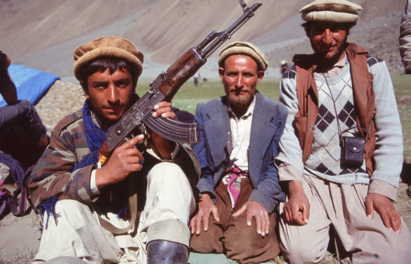
A group of local bandits I photographed and some days later they stole some of our equipment. Photo: Bob McKerrow

This was quite an expedition and the first mistake made, was letting a Frenchman buy the food without supervision. We ended up with pasta, stale and hard bread, rice, onions sugar and tea. There were no breakfast food, no milk powder, no salt, nuts, meat, chocolate meat or sardines. I wrote in my diary after six days we were starving. A group of armed locals stole equipment from us and Mathias was threatened by a soldier with an AK 47.
Approaching the Anjoman Pass from the Panjcher side of the Hindu Kush. In the background are peaks of Nuristan and Mir Sami to the right of centre. photo: Bob McKerrow

It took us five days to cross from the Panjcher Valley over Kotali Anjoman, down to Anjoman village, where we turned a sharp right up a side valley called Darrahe Paghar and set up a base camp at 4300 metres under Kohe Jalgya. The Anjoman Pass seperates Parwan province from Badakhshan province.


Our camp on the northern side of the Hindu Kush with Anjoman Pass the low depression to the right of centre. We spent a day here recovereing from a tiring crossing of the pass. Photio: Bob McKerrow

We soon realised that Kohe Jalgya was quite a technical climb and we didn’t have enough climbing equipment for such an ice climb. So Ross and Mathias headed for Kohe Jalgya and Bruce and I for another less technical climb, an unnamed peak at 5,300 metres.


Bruce Watson on a high point about 4800 metres near to Kohe Jalgya. The range in the background is part of the Jalgya massif. Photo: Bob McKerrow

On the ascent of Kohe Jalgya, Ross and Mathias spent a night half way up the peak. They made good progress the next day but found the ice climbing difficult. After negotiating the hardest part of the climb, they came to a small snow field where they had to plug through waist-deep snow near the summit. They turned back at 4 pm on the 6th of June as the weather closed in. The descent turned into an epic in worsening weather. Mathias had two axes for front pointing down the face, but Ross only had one which slowed him down. Mathias gave Ross one of his ice axes, and he used one axe and an ice screw as a dagger, to descend. About 9 pm, Mathias lost footing and fell down an icy coliour and tumbled head over heals for 300 metres, just coming to a stop before a rocky bluff. Although cut and bruised, he was able to wal on alone trying to find the tent. Meanwhile Ross continued descending alone in the dark on steep ice. Now seperated by 300 metres, Mathias managed to stagger back to their tent situated on a snow ledge. Ross kept down climbing on ice another two hours, reaching the tent at midnight.

Meanwhile at base camp, Bruce and I were anxiously waiting, for they were a day late. We had eaten our last spoon of milk powder, and had no food left, not even a cooker to make tea.

So on Saturday 8 June, Bruce and I left a note and emergency equipment under a rock cairn, and said we were leaving for the valley to buy a sheep, cook it and come up with some locals to effect a rescu

A young boy and his donkey in the Darrahe Paghar valley at the foot of Kohe Japgya. Photo: Bob McKerrow

We got down to a small hamlet in the valley about 4.30 pm and I glanced back at the mountain, and saw two specks slowly moving on the lower snow slopes of the mountain. It could only be Ross and Mathias. Bruce and I were elated. They were alive! We bought a stringy old female sheep and got the farmer to skin it, cut it up and boil it, preparing a feast for Ross and Mathias. Four hours later Mathias and Ross crossed the rising river, and joined us for a feast of mutton. Four days later we were back in Kabul.

Climbing up to the Anjoman Pass from the Badakhshan side. Photo: Bob McKerrow

For further information on mountaineering in Afghanistan, try this:http://bobmckerrow.blogspot.com/2011/08/climbing-and-exploring-in-hindu-kush.html

or this

even better

Wednesday, August 17, 2011

Two New Zealand Women climb new route on Koh-e-Baba-Tangi in Afghanistan

My heart leapt today when I got the news that sisters Patricia Deavoll and Christine Byrch climbed Koh-e-Baba-Tangi in Afghanistan. What a magnificent achievement ! I know the Wakhan well and saw it from inside Afghanistan, and different views from Tajikistan when I worked in both countries in the 1990s.

Here is the news first hand from Pat:

Christine and I summitted Koh-e-Baba-Tangi (6515m) in the Wakhan Corridor (Afgahnistan) on the 9th August. Five days to the summit with some good steep ice, then 2 days to decend the West Ridge (line of the original 1963 ascent). Ours is only the second climb of the mountain, done via a new route up the N'NW ridge.

Took a lot out of us...but we are very pleased.The Wakhan is a beautiful remote area unlike anywhere ive been.

Now back in Khorog, Tajikistan, on our way home.

Here is further information on ttheir amazing expedition
An aerial view of the Wakhan corridor, Afghanistan.

2010 New Zealand Women’s Mountaineering Expedition to the Wakhan Corridor,

Afghanistan

Patricia Deavoll and Christine Byrch

To make the first ascent of the North West Ridge of Koh-e-Baba-Tangi (6516m) in the Wakhan Corridor

Hindu Kush Range,Northern Afghanistan

Objective:

Koh-e-Baba Tangi is in the upper Kezget Valley, at the far end of the Wakhan Corridor and is considered by many mountaineers to be the most fascinating peak in the Afghan Hindu Kush. It was first climbed by an Italian team via the West Ridge. There are accounts of this expedition in:

• The American Alpine Club Journal 1964. pp 324-235
• The British AC Journal No. 308 May 1964.

Pat and Christine wish to make the second ascent of the mountain via the unclimbed North West Ridge, which will take them into an area rarely visited by climbers, and which has certainly not had a visit in the last thirty years. If the North West Ridge doesn’t offer a safe climbing option they will make their attempt via either the unclimbed East Ridge, or via the West Ridge (route of the first ascentionists).

Members:

Pat Deavoll
Christine Byrch

Pat and Christine are sisters.

Expedition duration: 15th July 2011- 30th August 2011.

Background:

The mountains of Afghanistan’s High Hindu Kush are located in the north east of the country, in the long finger of land known as the Wakhan Corridor, which separates Pakistan and Tajikistan. These mountains are gradually being revisited by climbers, who report the area to be remote, safe and worlds apart from the on-going war with the Taliban. Peaks in the Wakhan Corridor were hugely popular in the 1960’s and 70’s, particularly among European climbers who would often reach the area overland via the “hippy trail.” They were enticed by generally easier access than found in other parts of the Himalaya/ Karakoram, more stable weather and the ability to climb without the constraints of a restrictive permit system. But after the coup d’etat in 1978 and the Soviet Invasion in 1979 the climbing became strictly off-limits and remained so for
almost 30 years.

However in 2003 Carlo Alberto Pinelli, an Italian mountaineer who in the 1960’s climbed extensively in the area (and was one of the first ascentionists of Koh-e-Baba Tangi) organised an expedition he called the Oxuz: Mountains for Peace, with the objective of climbing Noshaq (7492m), Afghanistan’s highest mountain. He wanted to let the Afghan’s know they had not been forgotten by the climbers who had benefited from their generous hospitality. The successful expedition effectively marked the beginning of a new era of climbing in the region. Over the past five years a steadily increasing number of expeditions have, once again, enjoyed the superb climbing in the Afghan Hindu Kush.

Distinctive aims and objectives of the expedition:

• For two sisters from New Zealand to make the first ascent of the North West Ridge of Koh-e-Baba Tangi (6516m) in the Wahkan Corridor of the Hindu Kush Range of Afghanistan (second ascent of mountain)

• To showcase this neglected but fascinating region to other climbers worldwide and to determine its renewed safety as a mountaineering destination.

• To show solidarity towards the people of the Wakhan Corridor by supporting their economy, which has suffered over the past three decades with the demise of tourism.

• To showcase the abilities of strong female mountaineers in a male-dominant sport. Koh-e-Baba Tangi from Kezget

• To run an environmentally sound and socially conscientious expedition.

• To make a short amateur documentary on the expedition to be gifted to Wakhan Tourism for the promotion of future tourism in the area. We are hoping that a film of two western women travelling and climbing in Afghanistan will be of use to the organisation.

• To produce feature articles for leading outdoor publication on the expedition with the intention of promoting: a) the Afghan Hindu Kush as an area to climb, and b) the abilities of strong female mountaineers.

Intended route on Koh-e-Baba-Tangi

Description of North West Ridge Route from Guide Book (Peaks of Silver and Jade)

“The ascent of the Nth/Nth/West Spur…seems to be particularly attractive. It is a varied and hard route, but probably not to dangerous, alternating stretched of rock, mixed terrain and ice. Nothing is known about the bergschrund. A rock promontory protrudes from the glacier followed by an almost vertical ice dip. On top of it the slopes are less steep but then they straighten up once more along a small rocky ridge. From here a long crossing to the right could be attempted towards a large well visible ramp that takes you near the Western Ridge… It looks like and easy route. However it is partially exposed to the possible collapse of an overhanging barrier of seracs.

Above the little rocky ridge you proceed to your left on a second ridge until you land on a small snow plateau. The plateau ends at a spur of mixed terrain. Once you have negotiated this spur, you are soon on the summit.”

Detailed itinerary/schedule:

• Day 1: Arrive in Kabul

• Day 2: Shopping for food and equipment.

• Day 3: Fly to Faizabad.

• Day 4-5-6: Organisation with Wakhan Tourism and Mountain Unity.

• Day 7: Drive to village of Ishakashum .

• Day 9: Drive to Kandud

• Day 10: Drive to Kezget.

• Day 12-13: Trek to Basecamp (with expedition staff and porters/horses)

• Day 14-32: Acclimatization and climbing of Koh-e-Baba Tangi (6516m)

• Day 32-33: Trek to Kezget.

• Day 34-35: Drive to Ishakasum

• Day 36-40: Site seeing and liaison with Mountain Unity and Wakhan Tourism.

• Day 41: Flight to Kabul.

• Day 42: Leave Kabul for New Zealand


Why Pat and Christine think they will be successful:

Pat and Christine are two highly accomplished mountaineers; between them they have over fifty years of climbing experience. Pat has been on ten expeditions to Asia in the past nine years, all to climb mountains between 6000m and 7000m in height. Three of these (2007, 2008, 2009) have been to Afghanistan’s close neighbour, Pakistan, thus she is very aware of the risks of traveling in a Muslim country during periods of political unrest. Christine has also travelled extensively in Pakistan; therefore both women know how to conduct themselves as western women in an Islamic culture.

As a mountaineering partnership they climb well together, due mainly to the fact they are sisters and have known each other for ever! They are both extremely fit, despite their age. They have chosen Koh-e-Baba Tangi because it is a mountain of moderate height (6516m) and looks to be technically within their capabilities, but also, due to its position at the far end of the Wahkan Corridor, because it offers an exciting adventure just in reaching its base.

Both are confident they can summit Koh-e-Baba Tangi, if not by the North West Ridge, then via the East or West Ridge options.

For more, see Pat's blog: http://www.patdeavoll.co.nz/?page_id=697

My heartiest congratulations Pat and to your sister Christine. I am proud to be a Kiwi.

HERE IS SOME FURTHER INFORMATION ON THE WAKHAN

ALPINE EXPLORATION OF THE WAKHAN , .authored by HENRI AGRESTI published in 1972

An expedition in the Hindu Kush combines the delight of high mountain, the loveliness of the journey and exploration. That huge massif which stretches over nearly 1,000 km. can be divided into three parts—the occidental part is 5,143 m. high at Koh-e-Baba. The central Hindu Kush with its highest part in the Koh-e-Bandakor (6,600 m.) and which presents considerable interest for mountaineering but is rather well known nowadays. The best part for the alpinist is the high Hindu Kush which groups most of the seven-thousanders and numerous six-thousanders— its culminating point is Tirich Mir (7,706 m.) ascended in 1950 by the Norwegians from the valley of Chitral in Pakistan. We are not going to refer to that area of the high Hindu Kush attain­able from the south, but only about the less known part—the Wakhan. In fact, Wakhan is the narrow gully which separates the Hindu Kush from the mountains of the Soviet Pamir, but that same term is also used to characterize the northern’ part of the Hindu Kush attainable from Afghanistan.

In the whole of the Hindu Kush, the Wakhan is the part which has remained the least known up to now. The first expedition took place only in 1960. The reason why it has been so are simple. Before 1963 the access to the Wakhan was difficult because of the lack of roads. Even now, it depends on the summer season—when the torrents don’t cut the track, one can go as far as Quala Panja by jeep and by other vehicles; on the other hand, the permit to go to that region is not delivered every year so that some summers no climbing has been done, as has been the case in 1961 and 1967.

In 1960 a Japanese expedition climbed Noshaq (7 492 m) the second highest summit in Hindu Kush and the highest in Afghanistan—some days later a Polish expedition succeeded in the second ascent of the same summit. The two expeditions began the ascents of the Wakhan mountains and explored the most western part of the massif near its entrance.

1 This is a translation of one of the articles printed in an excellent booklet ‘Montagne arides du Wakhan’ by the author

In 1962 the second Polish expedition joined by four French­men (Moreau, Ginat, Bruneau and Langevin) explored the valleys of Mandaras and of Urgen-Bala, climbing Koh-e-Tez (6,800 m.) and Koh-e-Mandaras (6,600 m.).

The year 1963 is one of the most important in the discovery of these mountains. Six expeditions were given the permit to get to them, and for the first time, a group of alpinists penetrated far to the east, towards the plateau of Pamir. After having explored the different valleys, among which was the valley of Lunkho, the Italians climbed Baba-Tangi (6,513 m.). However, it is once more in the region of Noshaq that the main activity of alpinists could be seen. Two Austrian expeditions, one directed by Dr. Gruber and the other by Pilz, ascended the western crest and went over the ridge to Noshaq, thus realizing the third ascent of that summit. The same year a third Austrian expedition climbed Kishmi-Khan (6,700 m.) twice.

The same summer the third Polish expedition succeeded in the first ascent of Languta-e-Barfi and the third and fourth of Kishmi- Khan after a rather elaborate attempt on the northern spur of Shakhaur (7,000 m.). That attempt foreshadowed the advent of the 6 Sporting era’ in the Wakhan. To complete the year 1963, let us mention a Swiss expedition led by Eiselin. Over and above the seven-thousander Urgen, that expedition climbed Shash-Dhar (6,550 m.) and Urup (5,650 m.). At the end of 1963 the occidental part of Wakhan was well explored, but a lot of things had to be done further to the east. There numerous summits, often difficult, but not reaching more than 7,000 m. rose along over a hundred kilometres losing height gradually as it approached the plateau of Pamir—the crossroads where the Hindu Kush meets the Pamirs, the Tien-shan and the Kara- korams. If the present political situation remains unchanged these frontier massifs will, no doubt, remain difficult of access to the alpinists for a long time.

In 1964 a German expedition directed by Von Dobeneck climbed the 7,000 m. high Langar. Then because of the persistent bad weather—which is likely to be rather rare on a massif not subject to the monsoon—undertook the longest penetration to the east ever realized up to that time by alpinists—as far as the Chinese frontier. Their account, thrilling from the exploration and adventure standpoint, contains precious details about those mountains of Asia which are still very little known.

The following year an important Czech expedition climbed seventeen summits in the Ishmurgh valley at the foot of Lunkho.

It left untouched the main problem of that part, but revealed the existence of beautiful mountains with huge and very steep face which can be compared to the north face of the Grandes Jorasses, but twice as high and reaching to about 7,000 m.

The weather was still rather bad and it prevented the Czechs from their great realizations in this area.

In 1966 again, only one expedition obtained permit to get to the Wakhan, for only the first twenty kilometres of the valley. It’s in that way that the fourth Polish expedition, joined by a Belgian, J. Bourgeois, and two French, my wife and myself, succeeded in the ascent of Noshaq (7,492 m.) by the Austrians’ route and different virgin summits of no great importance such as the Sad-Istragh (5,800 m.), M. 10 (6,000 m.), Chap Zom (5,400 m.)… During an attempt on a seven-thousander, Barban Zom near Noshaq, Potocki disappears in an avalanche. Bour­geois and Heinrich succeed in returning to the main camp after a week of superhuman efforts and thanks to much luck.

Before 1968, the discovery of the Wakhan developed fairly well in the occidental part, the central and eastern valleys, in spite of some incursions, kept their problems unresolved. All the ambitions were directed in fact towards the Lunkho region and it is in this region that five out of the six expeditions of 1968 were made. The sixth one, a group of Frenchmen led by L. Dubost, climbed Koh-e-Lakhsh (5,786 m.) at the entrance of Wakhan from its northern spur.

Going on to the east we find in the Yamit valley an Italo- Polish expedition which is said to have climbed the western ramparts of Lunkho and different summits of less importance in this valley as well as some in Khandud.

In the Khandud valley two expeditions—an Austrian and a Yugoslavian—succeeded together on the same day the ascent of Lunkho-e-Dosare (6,868 m.); a few days later, on 13 August the Austrians succeeded in climbing the central tongue of Lunkho- e-Hawar (6,872 m.). They also made the first ascents of the summits of Wala No. 321 (6,450 m.) and No. 353 (6,434 m.), as well as the second ascent of Koh-e-Hevad (6,849 m.) and with the Yugoslavians the second ascent of the Koh-e-Myani (5,632 m.). In the Ishmurgh valley where a Czech expedition went in 1965, a Scottish expedition, directed by Ian Rowe, climbed the northern spur of Lunkho-e-Hawar, but did not reach the top and had to stop 100 to 200 metres lower. During that diffi­cult climbing, Alan North lost his left foot toes. More to the east we find in the Quala Panja valley, our expedition. The 1968 year has then been very important in the discovery and conquest of the central part of the Wakhan mountains, namely all the summits around Lunkho. Thus as far as Quala Panja all the valleys are known. Most of the summits have been reached. More to the east, however, all the summits are virgin, except for Baba-Tangi.

In 1969 seven groups went to the Wakhan. An American team (Hechtel) and an Austrian (Axt) went to Noshaq. A French group (Dabos) climbed Kishmi-Khan by opening a new route by its south-west pillar, while a Franco-Swiss group (Dittert) went to the region of Mandaras and climbed some five- thousanders. Isabelle and I went back for the third time to the Wakhan with a team from Lyon. We climbed the northern pillar of Shakhaur. A Japanese group went to the Pegish valley, and a French group to the Quala Panja valley to try Koh-e-Wakhan, the first ascent of which has been realized on the same date from the Pakistani side by Helga and Rudolph Lindner.[1]

Some summits are still waiting for lovers of beautiful problems. Lunkho-e-Hawar (6,872 m.) presents a wall 1,000-2,000 m. high and which stretches over several kilometres to the east as far as the Uparisina and to the west as far as the Lunkho-e-Dosare. More to the east, the Quala-e-Ust (6,300 m.)[2] is virgin. The seven-thousanders have often been climbed only by a single route—walls of over 2,000 m. are not rare—around Shakhaur they reach 3,000 m. Beautiful granite pillars which remind you of the southern aspects of Mont Blanc but rise to 6,000-7,000 m. here and there. Let us mention for instance those we have seen on the Sad-Istragh, the Koh-e-Setara, the Saraghrar…

Notes on Summit Identification by Dr. A. Diemberger

Rahezom Zom North = Koh-e-Wakhan

In 1968 Henry and Isabella Agresti also reconnoitred Koh-e- Wakhan, the imposing summit in the south-east corner of the east glacier of the valley of Quala Panja. For this purpose they climbed two summits beside Col. Est (5,650 m.).

Southwards from Koh-e-Wakhan, and separated by a Col, towers another high peak which appears to belong to the system of Koh-e-Wakhan. Dr. Gerald Gruber names, in OAZ Fg. 1365, these two peaks Rahezom Zom North and South Height according to Agresti: North peak 6,400 m. South peak 6,636 m. Height according to Gruber: North peak 6,535 m. South peak 6,502 m. (taken from quarter inch and from Wala maps).

In 1969 Helga and Rudolf Lindner attacked both peaks from the south, from Chitral. From the Chi-Gari glacier, that is from south-west, they reached by step cutting, the big Col between the north and south peaks. They named this beautiful and broad Col ‘Silver Saddle’.

From Silver Saddle they scaled first on 4.8.69 the North peak and thereafter on 6.8.69 the South peak. They found that the South peak was higher than the North peak. The altitude meter showed a difference of approx 120 m. It would have been purposeful—and H. Agresti and G. Gruber would have agreed to it—to give the name Koh-e-Wakhan to the North peak. It lies on the border ridge between Wakhan and Chitral and is acces­sible from Wakhan. The name Rahezom Zom could be for the South peak which exists totally independent of the North peak It is pushed towards Chitral. Provisional height approx: Koh- e-Wakhan above 6,400 m., Rahezom Zom about 6,550 m The Lindners found no sign of any previous climbing on the North peak. On the peak edge one could only ride. Clear peak photos show, in the east Ouala Wust, above 6,300 m„ and Baba-Tangi above 6,500 m.

An Alpine Magazine reported a scaling of Koh-e-Wakhan from the north side on 2.8.69. That is, two days before the scaling of the Lindner team. Now the problem has been cleared. On 2.8.69 a French team came from north side up to the cornices below the summit of Koh-e-Wakhan, but could not reach the summit.

Further notes on the article by Henri Agresti in the Himalayan Journal, Vol. XXIX, 1969, by Dr. A. Diemberger.

The credit to Henry Agresti regarding the opening up of the Ouala Panja Valley cannot be sufficiently stressed. A few more remarks on the article on pp. 65 and 66, and on the ridge sketch.

1. The first summit north of Koh-e-Tirma (5,950 m ) is Koh-e-Andaval, approx. 5,640 m. In 1968 it was scaled by a Scottish Team from the Ishmurgh Valley.

2. Between Koh-e-Tirma and Koh-e-Setara (6,050 m.), a group of three summits lie, one said to have a height of 6,150 m.

H. Agresti takes all these three summits under a provisional name Koh-e-Bakera. The western one is a neve summit, the eastern one a complex of rock towers. These summits have not been scaled yet (1970) and deserve an ascent.

3. Further references:

(a) H.J., Vol. XXIX, 1969, pp. 65-66, 67-69, 69-70, 71-74 (the first three being reprints from A.J., 1969).

(b) A.J., 1970, pp. 169-172 (Austrian Expedition, 1969), p. 173 (American Expedition, 1969), pp. 173-174 (French Expedition, 1969), pp. 174-175 (Franco-Swiss Expedition, 1969), pp. 175-176 (French ascent of Shakhaur, 1669) (reprinted in H.J., Vol. XXX, 1970 pp. 275-277).

(c) H.J., Vol. XXX, 1970, pp. 264-269 (Austrian Expedi­tion, 1969), pp. 282-300 (Review of Scottish Expedi­tions, 1965-1970).

(d) AJ., 1971, pp. 213-214 (British Expedition, 1970), pp. 214-216 (Austrian Expedition, 1970).

(e) A.AJ., 1971, pp. 456-461 (Various Expeditions of 1970).

-------------------------------------------------------------------------------
[1] See Dr. A. Diemberger’s notes which immediately follow this article regarding Koh-e-Wakhan and the 1968 French Expedition to Quala Panja.

[2] Also spelt Quala Wust.

Sunday, August 14, 2011

Expeditions and climbs in the Hindu Kush - Afghanistan

Today I took time to update various climbs and expeditions I went on in Afghanistan during the period, 1993-1996.
John Tinker (l) and Ian Clarke with Mir Samir in the background. The route they attempted was a ridge on the face just to the left of centre to the left of a small avalanche in a snow gulley: Photo: Bob McKerrow


FROM THE AMERICAN ALPINE JOURNAL 1995
Mir Samir and ascent of P5000. After years when it was too dangerous to enter the mountains of Afghanistan, New Zealander Bob McKerrow and Englishmen Ian Clarke and Jon Tinker headed for Mir Samir in the Hindu Kush. McKerrow is head of the International Red Cross in Afghanistan and Clarke is a former Royal Marine, now head of the Halo Trust mine clearance organisation in Afghanistan.

Tinker has worked in the country a number of times in the last seven years.The three climbers set out from Kabul on September 23, 1994, acclimatizing near the Salang Pass before setting out for Parian in the upper Panjchir.
Above, he peak climbed solo by Bob McKerrow on 1 October 1994. The peak was named P5000 by the American Alpine Journal 1995. The photo is taken from the Chamar Valley. 


There four horses were hired to carry food and equipment up the Chamar valley to base camp at 3,400 m. Clarke's skills were put to the test when the saw air-dropped scatterable anti-personnel mines.


They established a high camp at 4,300 m on September 29.Because of the deep snow, the two Englishmen made slow progress the next day to bivouac at 4,900 meters on an unclimbed snow route on the southwest face of Mir Samir. On October 1 they made While Clarke and Tinker were climbing Mir Samir, McKerrow climbed an unclimbed peak at approximately 5000 metres, a prominent feature when viewed from the Chamar Valley. a summit attempt.but unseasonable deep snow turned the back at 5200 meters, some 600 meters from the summit.(end of article from American Alpine Club Journal, 1995)


We spent a few night in the Panjcher valley. This trigger-happy commander put us up for a few nights free. Photo: Bob McKerrow


Tinker with parts of land mines which we found scattered through the region. Photo: Bob McKerrow


Bob McKerrow (l) with John Tinker at Base Camp on Mir Samir. Photo: Bob McKerrow

The donkey that carried our supplies in with Mir Samir in the background. Photo: Bob McKerrow


I couldn't resist putting the photo of Eric Newby taken on their attempt on Mir Samir in 1956 and an extract from his obituary in the New York Times, October 24, 2006.


Fifty years ago, in the summer of 1956, Mr. Newby set out on the trip that would make him famous: a voyage by station wagon, foot and horseback to climb Mir Samir, a 20,000-foot peak in Nuristan, a wild region in northeastern Afghanistan. The fact that he had never climbed a mountain did not deter him in the slightest.

Mir Samir. Photo: Bob McKerrow


Mr. Newby chronicled the trip in “A Short Walk in the Hindu Kush,” published in Britain by Secker & Warburg in 1958 and in the United States by Doubleday the next year. As in all his work, the narrative was marked by genial self-effacement and overwhelming understatement.

Bob McKerrow reading some pages from Eric Newby's A Short Walk in the Hindu Kush to children whose Grandfathers helped Newby. We retraced a large part of their journey, Photo: Bob McKerrow


Reviewing the book in The New York Times Book Review in 1959, William O. Douglas, a noted travel memoirist who by day was a justice of the United States Supreme Court, called the book “a chatty, humorous and perceptive account.” He added: “Even the unsanitary hotel accommodations, the infected drinking water, the unpalatable food, the inevitable dysentery are lively, amusing, laughable episodes.”


Here is the article I wrote on various climbs in Afghanistan we did between 1993 and 1996.


No foreigners have climbed in Afghanistan since the Soviets arrived in late 1978. I had heard about the passes and valleys strewn with land mines so it was with some trepidation I embarked from Kabul in October 1994 on what was probably the first expedition into the Hindu Kush for at least 17 years.
Roads in the Hindu Kush are difficult to negotiate in winter. We are heading up to the Salang Tunnel which is the only tunnel through the Hindu Kush. Photo: Bob McKerrow


I travelled with two British climbers, Ian Clarke and John Tinker, to the Chamar valley for an attempt Mir Samir, a peak made famous by Eric Newby in his book, A Short Walk in the Hindu Kush. Tinker was fresh off an ascent of Everest by a new route on the north side and Clarke was head of a British Mine clearance organisation in Afghanistan and was a necessary companion as the area had received large amounts of small scatterable mines, dropped from Soviet aircrafts to prevent the freedom fighters crossing the mountain passes.

Having lunch at our base camp with a bunch of Pashtoon soldiers returning from just being released from prison in the north, to their home in the east of Afghanistan, a journey of 400 km through remote wild mountain areas. John Tinker left, and Ian Clarke 3rd from left. Photo: Bob McKerrow


Our safety was dependent on his knowledge of mines and where battles had taken place. Tinker and Clarke attempted an unclimbed face on Mir Samir and got surprising high considering the unseasonably soft snow that had fallen.
The mountains to the extreme left of Mir Samir at the head of the Chamar Valley. Photo: Bob McKerrow


While the others were attempting Mir Samir, I climbed an unnamed peak around 5000 metres and looked over to the enticing mountains of Nuristan, formerly Kafirstan. We explored a number of neighbouring regions with the hope of returning to do further climbing. .In June 1995 I did another trip was Clarke, crossing from the Panjcher valley to southern Badakshan by way of the 4260 m Anjuman Pass.


Early 1995, Ian Clarke and I did another trip over the Anjuman Pass on a journey towards the Wakhan Corridor. Photo: Bob McKerrow


It was a unique opportunity to explore this spectacular part of the Hindu Kush and check routes on the major peaks in the area ranging from 5900 to 6500 metres.

A rather dubious group we came across. Photo: Bob McKerrow


One of the best peaks in the area in Kohi Bandak. The highlight of the trip was when returning back over the Anjuman Pass when at about 3400 metres in high alpine pastures we met about 50 Kuchi (nomad) families on their annual journey to this area. Some were on the move, other camping in their black, low-slung goat hair tents. We passed strings of camels with babies and young children with intricately embroidered bonnets, tied on the backs.


Camped at a lake on the northern side of the Hindu Kush. We crossed by Kotali Anjuman, the low pass on the right. Photo: Bob McKerrow


Kuchi nomads wending their way through the Hindu Kush.


Young girls with page-boy style hair cuts, flashed their shy blue eyes at us as we passed.

We stopped in tents to share pots of tea and watched how they cared for their animals. Young goats were inside the tent, sheltering from the hot sun, women tenderly carried young lambs in their arms, and an old lame sheep, rode past on the back of a camel. Over the hillsides women and children were gathering alpine herbs, wood, leaves and wild vegetables. Nearby an old women was weaving a carpet. This is what the mountains of Afghanistan are about, tough friendly mountain people who have a symbiotic relations with the hills. They name their children after the mountains, names such as ‘Kohzad’, meaning of the mountains.


Kuchi nomads on the move.


Despite the warmth of the people, many disasters befall them. Thousands are killed annually by avalanches and landslides. In late March word reached Kabul that a massive landslides had hit the village of Qarluk, situated high in the mountains of Badakhshan.
I was part of a Red Cross survey team that walked and rode by horse to the site. The whole village had been engulfed killing 350 people, all women and children. The landslide occurred at 11 am when the men and boys were out in the fields and the women. We arrived to find only one female survivor, 11 year old Gulnesa Beg, her arm broken in two places and with her good arm, hugging her father. A whole village wiped out by nature. Here we spent weeks running a relief operation to assist during the emergency phase and started helping these rugged Hazara people put their lives back together again.

In August 1996, the highlight of my time in Afghanistan was a trip to Nuristan, the legendary 'land of light'.
Parun Valley, Nuristan. Photo: Bob McKerrow


The Afghan Red Cross is establishing a medical clinic in the Parun valley and I went with our medical staff. Nuristan hugs the southern side of the Hindu Kush and is been isolated from the rest of the country. Six main valleys make up Nuristan each with their own language and for four to five months of the year, the mountain passes in and out of Nuristan are blocked. In is an area where snow panthers, wolves and fox thrive in forests almost untouched by human hand, this is paradise on earth. These blue-eyed and sometimes blond haired people claim they are either descendants of the original Aryans, while others say they are descendants of Alexander the Great. In 1895 they were forcibly converted to Islam and even today their are remnants of their former pagan past. Nuristani villages cling to mountain sides, sometimes perched on peak-tops. a legacy of the past to avoid invaders. Like the mountain Tajiks, the Nuristanis are true mountaineers. In 1889 George Robertson the author of the book ‘Kafirs of the Hindu Kush’, described the Nuristanis as" 'magnificent mountaineers<-"' because of their mountain skills, fitness and agility.
Skiing near the Salang Pass. Photo: Bob McKerrow

The northern entrance to the Salang Tunnel and the men who keep the road open. February 1996. Bob McKerrow

  McKerrow and Tinker sorting out gear at Base Camp in 1994. Photo: Bob McKerrow

The writer sitting on an old Soviet tank. Photo: Bob McKerrow

Our last climbs in Afghanistan were in June 1996. I went with Mathias Luft, Ross Everson and Bruce Watson. Mathias and Ross climbed  Kohe Jalgya 6260m, the peak in the background in the photo above. Bruce and I climbed a 5300 m peak. Photo: Bob McKerrow 


This was quite a difficult expedition and the first mistake made, was letting a Frenchman buy the food without supervision. We ended up with pasta, stale and hard bread, rice, onions sugar and tea. There were no breakfast food, no milk powder, no salt, nuts, meat, chocolate meat or sardines. I wrote in my diary after six days we were starving. A group of armed locals stole equipment from us and Mathias was threatened by a soldier with an AK 47.

Bruce Watson on our Kohe Jalgya expedition at about 4,800 metres, just above our base camp. Photo: Bob McKerrow 

It took us five days to cross from the Panjcher Valley over Kotali Anjoman, down to Anjoman village, where we turned a sharp right up a side valley called Darrahe Paghar and set up a base camp at 4300 metres under Kohe Jalgya.

We soon realised that Kohe Jalgya was quite a technical climb and we didn’t have enough climbing equipment for such an ice climb. So Ross and Mathias head for Kohe Jalgya and Bruce and I for another less technical climb, an unnamed peak at 5,300 metres.

On the ascent of Kohe Jalgya, Ross and Mathias spent a night half way up the peak. They made good progress the next day but found the ice climbing difficult. After negotiating the hardest part of the climb, they came to a small snow field where they had to plug through waist-deep snow near the summit. They turned back at 4 pm on the 6th of June as the weather closed in. The descent turned into an epic in worsening weather. Mathias had two axes for front pointing down the face, but Ross only had one which slowed him down. Mathias gave Ross one of his ice axes, and he used one axe and an ice screw as a dagger, to descend. About 9 pm, Mathias lost footing and fell down an icy coliour and tumbled head over heals for 300 metres, just coming to a stop before a rocky bluff. Although cut and bruised, he was able to walk. Meanwhile Ross continued descending alone in the dark on steep ice. Now seperated by 300 metres, Mathias managed to stagger back to their tent situated on a snow ledge. Ross kept down climbing on ice another two hours, reaching the tent at midnight.

Meanwhile at base camp, Bruce and I were anxiously waiting, for they were a day late. We had eaten our last spoon of milk powder, and had no food left, not even a cooker to make tea.

So on Saturday 8 June, Bruce and I left a note and emergency equipment under a rock cairn, and said we were leaving for the valley to buy a sheep, cook it and come up with some locals to effect a rescue.

We got down to a small hamlet in the valley about 4.30 pm and I glanced back at the mountain, and saw two specks slowly moving on the lower snow slopes of the mountain. It could only be Ross and Mathias. Bruce and I were elated. They were alive! We bought a stringy old female sheep and got the farmer to skin it, cut it up and boil it, preparing a feast for Ross and Mathias. Four hours later Mathias and Ross crossed the rising river, and joined us for a feast of mutton. Four days later we were back in Kabul.


Two of the best ! Over the years i have climbed with many high competent mountaineers but John Tinker (left) and Ian Clarke (right) are two of the best I have climbed with. We did an expedition to Mir Samir together and Clarke and I did a recce of the Anjuman Pass area in 1995, trying to reach the Wakhan.  The central Hindu Kuah in the background.


So during the three years I lived and worked in Afghanistan, (1993-96), I was fortunate to get out to many parts of the Hindu Kush, and explore, trek and climb. With the difficult security situation today, I am so grateful to have taken that opportunity. On reflection, I suppose it was minefield mountaineering. Thanks to Ian Clarke for giving me the confidence to travel in a country that was heavily mined, and teaching me what was safe and what was not.